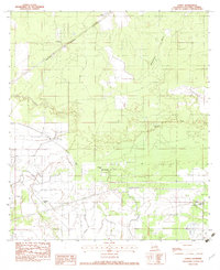
1982 Map of Lunita
USGS Topo · Published 1983About this map
Lunita sits along the Kansas City Southern railroad line in this 1982 survey of Calcasieu Parish. The landscape is defined by the winding course of the Houston River and a network of drainages including Persimmon Gully and Coon Gully. This era shows the impact of large-scale water management via the Sabine River Diversion System, which cuts a straight path across the southern half of the map, contrasting with the natural meanders of the local rivers.
Find a feature on this map
13 named features on this map. Tap any name to fly to it.
Don’t see what you’re looking for? This feature index may not catch every label — zoom into the map to look around manually.
Map Details
Editions of this 1982 Lunita Map
This is the sole edition of this map. No revisions or reprints were ever made.
Other maps of this area

1932 · Orange
USGS Topo · 1:62,500

1947 · Sulphur
USGS Topo · 1:31,680

1947 · Starks
USGS Topo · 1:31,680

1947 · Vinton
USGS Topo · 1:31,680

1947 · Toomey
USGS Topo · 1:31,680

1947 · Carter Creek
USGS Topo · 1:31,680

1947 · DeQuincy
USGS Topo · 1:31,680

1947 · Sulphur Mines
USGS Topo · 1:31,680

1947 · Lunita
USGS Topo · 1:31,680

1947 · Long Marsh
USGS Topo · 1:31,680