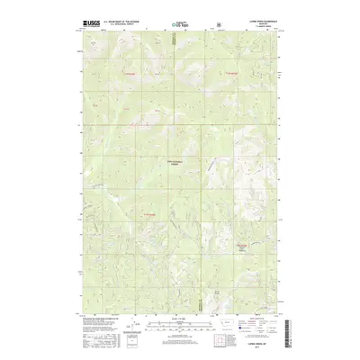
2017 Map of Lupine Creek
USGS Topo · Published 2017About this map
The high watershed of the Lolo National Forest along the border of Mineral and Missoula counties defines this portion of the Montana Rockies. Centered on the namesake Lupine Creek, the terrain is etched by a dense network of mountain streams including Burdette Creek, Howard Creek, and South Fork Petty Creek. The map documents a complex system of Forest Service access routes, such as Wagon Mountain Road and South Fork Fish Creek Road, which navigate the steep topography between Spring Gulch and the high elevations. The southeastern portion of the quadrangle opens into the Howard Creek Meadows, a notable high-altitude clearing. This 2017 survey provides a precise record of the contemporary drainage patterns and logging road infrastructure within the Bitterroot range before recent environmental changes or land-use shifts.
Find a feature on this map
31 named features on this map. Tap any name to fly to it.
Don’t see what you’re looking for? This feature index may not catch every label — zoom into the map to look around manually.
Map Details
Editions of this 2017 Lupine Creek Map
This is the sole edition of this map. No revisions or reprints were ever made.
Other maps of this area

1911 · Lolo
USGS Topo · 1:250,000

1912 · Missoula
USGS Topo · 1:125,000

1913 · Lolo
USGS Topo · 1:250,000

1956 · Hamilton
USGS Topo · 1:250,000

1959 · Hamilton
USGS Topo · 1:250,000

1960 · Hamilton
USGS Topo · 1:250,000

1964 · Hamilton
USGS Topo · 1:250,000

1964 · Lolo Hot Springs
USGS Topo · 1:24,000

1964 · Garden Point
USGS Topo · 1:24,000

1964 · West Fork Butte
USGS Topo · 1:24,000