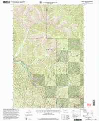
1999 Map of Lupine Creek
USGS Topo · Published 2003About this map
Lolo National Forest encompasses the entirety of this landscape on the border of Mineral and Missoula counties. The rugged drainage patterns are defined by the confluence of several key waterways, including Lupine Creek and its southern fork, which meet near the historical location of Grovedale. This area serves as a vital watershed for Fish Creek and Lolo Creek, illustrating the complex hydrological network of the Northern Rockies.
Find a feature on this map
22 named features on this map. Tap any name to fly to it.
Don’t see what you’re looking for? This feature index may not catch every label — zoom into the map to look around manually.
Map Details
Editions of this 1999 Lupine Creek Map
This is the sole edition of this map. No revisions or reprints were ever made.
Other maps of this area

1911 · Lolo
USGS Topo · 1:250,000

1912 · Missoula
USGS Topo · 1:125,000

1913 · Lolo
USGS Topo · 1:250,000

1956 · Hamilton
USGS Topo · 1:250,000

1959 · Hamilton
USGS Topo · 1:250,000

1960 · Hamilton
USGS Topo · 1:250,000

1964 · Hamilton
USGS Topo · 1:250,000

1964 · Lolo Hot Springs
USGS Topo · 1:24,000

1964 · Garden Point
USGS Topo · 1:24,000

1964 · West Fork Butte
USGS Topo · 1:24,000