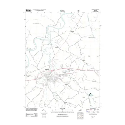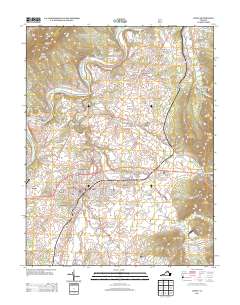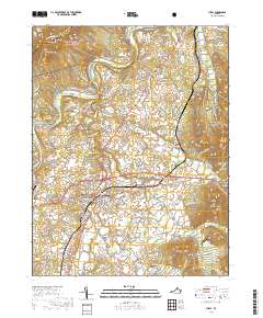
1972 Map of Luray
USGS Topo · Published 1974About this map
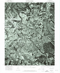
Luray and the surrounding Shenandoah Valley landscape appear in striking detail in this 1972 orthophotomap. Unlike a traditional topographic sheet, this aerial perspective, prepared under State Geologist James L. Calver, reveals the precise patchwork of agricultural fields and the winding course of the Shenandoah River as it meanders through the valley floor. The eastern slopes of Massanutten Mountain dominate the western edge of the frame, providing a clear visual of the era's land use patterns and forest cover. The street grid of the town is clearly visible, showing the residential and commercial layout just before mid-1970s development. This photographic record captures the intersection of the natural mountain geography with the established rural infrastructure of Page County.
Find a feature on this map
2 named features on this map. Tap any name to fly to it.
Don’t see what you’re looking for? This feature index may not catch every label — zoom into the map to look around manually.
Map Details
Editions of this 1972 Luray Map
This is the sole edition of this map. No revisions or reprints were ever made.
Historical Maps of Luray Through Time
10 maps found