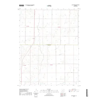
2019 Map of Lusto Springs
USGS Topo · Published 2019About this map
Lusto Springs serves as a central landmark in this 2019 survey, situated along the county line where Washington and Lincoln counties meet. The landscape is defined by the ephemeral drainage patterns of the High Plains, with Vega Creek and its smaller tributary Vega Cr carving shallow paths toward the south. The southern edge of the quadrangle is anchored by the N Fork Arikaree River, a vital water source in this semi-arid region.
Find a feature on this map
34 named features on this map. Tap any name to fly to it.
Don’t see what you’re looking for? This feature index may not catch every label — zoom into the map to look around manually.
Map Details
Editions of this 2019 Lusto Springs Map
This is the sole edition of this map. No revisions or reprints were ever made.
Other maps of this area

1891 · Limon
USGS Topo · 1:125,000

1892 · Limon
USGS Topo · 1:125,000

1954 · Limon
USGS Topo · 1:250,000

1957 · Limon
USGS Topo · 1:250,000

1958 · Limon
USGS Topo · 1:250,000

1970 · T Draw
USGS Topo · 1:24,000

1973 · Last Chance SW
USGS Topo · 1:24,000

1973 · Last Chance NW
USGS Topo · 1:24,000

1973 · Lusto Springs
USGS Topo · 1:24,000

1973 · Lindon SW
USGS Topo · 1:24,000