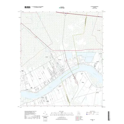
2018 Map of Lutcher
USGS Topo · Published 2018About this map
The Mississippi River carves a deep arc through this section of the river parishes, anchoring a landscape where historical sugar culture and river transport have left a permanent mark. On the east bank, the established riverfront towns of Lutcher and Gramercy are densely gridded with neighborhood streets such as Matherne Rd and N Albert St, reflecting their growth as industrial hubs. Across the water, the Grandview Reach and Fifty-mile Point orient the rural settlements of Vacherie and North Vacherie. This survey highlights the deep ancestral roots of the area, noting numerous interment sites including the Saint Philip Cem and Mausoleum and the Western Cem. Inland from the river, the terrain shifts abruptly to the low-lying wetlands of the Maurepas basin, defined by a network of drainage infrastructure like the Tennessee Williams Canal and the natural winding course of the Blind River.
Find a feature on this map
118 named features on this map. Tap any name to fly to it.
Don’t see what you’re looking for? This feature index may not catch every label — zoom into the map to look around manually.
Map Details
Editions of this 2018 Lutcher Map
This is the sole edition of this map. No revisions or reprints were ever made.
Other maps of this area

1892 · Lac Des Allemands
USGS Topo · 1:62,500

1892 · Mount Airy
USGS Topo · 1:62,500

1892 · Donaldsonville
USGS Topo · 1:62,500

1892 · Thibodaux
USGS Topo · 1:62,500

1932 · Lac Des Allemands NW
USGS Topo · 1:31,680

1932 · Thibodaux NE
USGS Topo · 1:31,680

1932 · Lac Des Allemands NE
USGS Topo · 1:31,680

1939 · Donaldsonville
USGS Topo · 1:62,500

1940 · Lagan
USGS Topo · 1:31,680
1941 · Lac Des Allemands
USGS Topo · 1:62,500