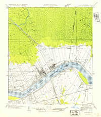
1954 Map of Lutcher
USGS Topo · Published 1954About this map
The Mississippi River creates a dramatic curve at Willow Bend, anchoring a landscape defined by the sugar industry and river-based commerce. The narrow-lot ribbon farms typical of French colonial settlement extend from the riverbanks toward the northern swamplands, where Tchackchou Bayou and Bayou des Jones thread through the lowlands. This agricultural pattern is punctuated by industrial landmarks like the Longview Sugar Mill near Remy and the Evergreen Sugar Mill further downstream, illustrating the era's reliance on river access and the Illinois Central Railroad for transport.
Find a feature on this map
41 named features on this map. Tap any name to fly to it.
Don’t see what you’re looking for? This feature index may not catch every label — zoom into the map to look around manually.
Map Details
Editions of this 1954 Lutcher Map
This is the sole edition of this map. No revisions or reprints were ever made.
Other maps of this area

1892 · Lac Des Allemands
USGS Topo · 1:62,500

1892 · Mount Airy
USGS Topo · 1:62,500

1892 · Donaldsonville
USGS Topo · 1:62,500

1892 · Thibodaux
USGS Topo · 1:62,500

1932 · Lac Des Allemands NW
USGS Topo · 1:31,680

1932 · Thibodaux NE
USGS Topo · 1:31,680

1932 · Lac Des Allemands NE
USGS Topo · 1:31,680

1939 · Donaldsonville
USGS Topo · 1:62,500

1940 · Lagan
USGS Topo · 1:31,680
1941 · Lac Des Allemands
USGS Topo · 1:62,500