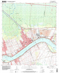
1998 Map of Lutcher
USGS Topo · Published 2001About this map
Mississippi River riverfront life and industrial operations define this landscape in the late 1990s, where traditional settlements like Lutcher and Gramercy sit alongside massive tailings ponds. This stretch of St. James Parish preserves historic sites such as Evergreen Plantation and the Woodville Cemetery, highlighting the deep roots of the local community. Further inland, the map transitions into the cypress-laden backwaters of Bayou Tchackchou and the Blind River, intersected by the Tennessee Williams Canal and various pipeline corridors.
Find a feature on this map
48 named features on this map. Tap any name to fly to it.
Don’t see what you’re looking for? This feature index may not catch every label — zoom into the map to look around manually.
Map Details
Editions of this 1998 Lutcher Map
This is the sole edition of this map. No revisions or reprints were ever made.
Other maps of this area

1892 · Lac Des Allemands
USGS Topo · 1:62,500

1892 · Mount Airy
USGS Topo · 1:62,500

1892 · Donaldsonville
USGS Topo · 1:62,500

1892 · Thibodaux
USGS Topo · 1:62,500

1932 · Lac Des Allemands NW
USGS Topo · 1:31,680

1932 · Thibodaux NE
USGS Topo · 1:31,680

1932 · Lac Des Allemands NE
USGS Topo · 1:31,680

1939 · Donaldsonville
USGS Topo · 1:62,500

1940 · Lagan
USGS Topo · 1:31,680
1941 · Lac Des Allemands
USGS Topo · 1:62,500