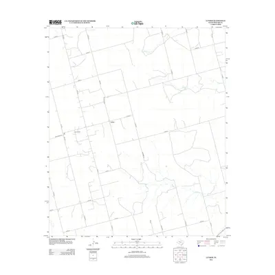
2012 Map of Luther
USGS Topo · Published 2012About this map
Luther serves as the central focal point for this section of Howard County, appearing as a concentrated settlement in a landscape largely defined by its natural drainage and petroleum industry. The surrounding terrain is carved by the winding paths of Wildcat Cr, Morgan Cr, and Wildhorse Cr, which dictate the local topography. A significant industrial footprint is evident at the Luther Oil Field, situated just west of the town center near the intersection of Gail Hwy and Ranch Road 846. The map reveals a highly structured grid of rural infrastructure, where routes like Kennemer Rd and Fryar provide access to the expansive agricultural and oil-producing tracts that characterize this part of the Texas Permian Basin region.
Find a feature on this map
31 named features on this map. Tap any name to fly to it.
Don’t see what you’re looking for? This feature index may not catch every label — zoom into the map to look around manually.
Map Details
Editions of this 2012 Luther Map
This is the sole edition of this map. No revisions or reprints were ever made.
Other maps of this area

1942 · Big Spring North
USGS Topo · 1:62,500

1954 · Big Spring
USGS Topo · 1:250,000

1954 · Big Spring North
USGS Topo · 1:24,000

1954 · Big Spring North NE
USGS Topo · 1:24,000

1958 · Big Spring
USGS Topo · 1:250,000

1965 · Big Spring North
USGS Topo · 1:24,000

1966 · Knott SE
USGS Topo · 1:24,000

1966 · Knott NE
USGS Topo · 1:24,000

1970 · Vealmoor
USGS Topo · 1:24,000
1970 · Gunsight Draw
USGS Topo · 1:24,000