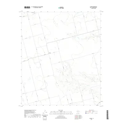
2019 Map of Luther
USGS Topo · Published 2019About this map
Luther serves as the central hub of this Howard County landscape, situated at the intersection of FM 846 and N Co Rd 33. The region is defined by a series of drainage systems that carve through the high plains, most notably Wildhorse Cr which winds through the southern portion of the quadrangle. Other significant waterways include Wildcat Cr to the north and Morgan Cr in the northeast, while Dorward Draw marks the northwest corner of the survey.
Find a feature on this map
33 named features on this map. Tap any name to fly to it.
Don’t see what you’re looking for? This feature index may not catch every label — zoom into the map to look around manually.
Map Details
Editions of this 2019 Luther Map
This is the sole edition of this map. No revisions or reprints were ever made.
Other maps of this area

1942 · Big Spring North
USGS Topo · 1:62,500

1954 · Big Spring
USGS Topo · 1:250,000

1954 · Big Spring North
USGS Topo · 1:24,000

1954 · Big Spring North NE
USGS Topo · 1:24,000

1958 · Big Spring
USGS Topo · 1:250,000

1965 · Big Spring North
USGS Topo · 1:24,000

1966 · Knott SE
USGS Topo · 1:24,000

1966 · Knott NE
USGS Topo · 1:24,000

1970 · Vealmoor
USGS Topo · 1:24,000
1970 · Gunsight Draw
USGS Topo · 1:24,000