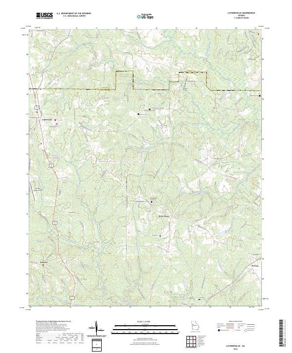
2024 Map of Luthersville
USGS Topo · Published 2024About this map
Luthersville serves as the primary hub in this portion of Meriwether Co, where the landscape is defined by the headwaters of numerous creeks including Red Oak Creek, Panther Creek, and Brittens Creek. The area shows a transition from the town's street grid, including N Main St and College St, to a more rural network of roads like Strickland Town Rd and Meadows Boone Rd. Several historical burial grounds are scattered throughout the countryside, such as the Strickland Town Cem, Hannah Cem, and Dunlap Cem, providing essential points of interest for genealogists tracing local families. The presence of Johnson Airport and Flying N Estates Airport highlights a modern aviation influence amidst the traditional agricultural terrain. Small water bodies like Dolliver Lake and Massey Lake are tucked into the drainage basins, while the settlement of Rocky Mount anchors the central portion of the quadrangle.
Find a feature on this map
88 named features on this map. Tap any name to fly to it.
Don’t see what you’re looking for? This feature index may not catch every label — zoom into the map to look around manually.
Map Details
Editions of this 2024 Luthersville Map
This is the sole edition of this map. No revisions or reprints were ever made.
Other maps of this area

1953 · Atlanta
USGS Topo · 1:250,000

1957 · Atlanta
USGS Topo · 1:250,000

1958 · Atlanta
USGS Topo · 1:250,000

1964 · Grantville
USGS Topo · 1:24,000
1964 · Odessadale
USGS Topo · 1:24,000

1965 · Newnan South
USGS Topo · 1:24,000

1965 · Senoia
USGS Topo · 1:24,000

1965 · Sharpsburg
USGS Topo · 1:24,000
1971 · Luthersville
USGS Topo · 1:24,000
1971 · Greenville
USGS Topo · 1:24,000