
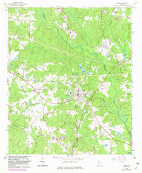
1965 Map of Senoia
USGS Topo · Published 1967About this map
The town of Senoia serves as the geographic heart of this mid-1960s survey, where the Atlantic Coast Line and Central of Georgia railroads intersect. This era captures the region before the significant suburban expansion of Peachtree City, which appears here in its early stages along the northern Coweta and Fayette County line. The landscape is a network of small family-named landmarks and rural institutions, such as Starrs Mill at Starrs Millpond and the nearby Starrs Mill Ch.
Find a feature on this map
82 named features on this map. Tap any name to fly to it.
Don’t see what you’re looking for? This feature index may not catch every label — zoom into the map to look around manually.
Map Details
Editions of this 1965 Senoia Map
2 editions found
Other maps of this area

1953 · Atlanta
USGS Topo · 1:250,000

1957 · Atlanta
USGS Topo · 1:250,000

1958 · Atlanta
USGS Topo · 1:250,000

1965 · Tyrone
USGS Topo · 1:24,000

1965 · Fayetteville
USGS Topo · 1:24,000

1965 · Madras
USGS Topo · 1:24,000

1965 · Brooks
USGS Topo · 1:24,000

1965 · Sharpsburg
USGS Topo · 1:24,000
1971 · Luthersville
USGS Topo · 1:24,000

1971 · Hollonville
USGS Topo · 1:24,000