
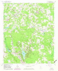
1965 Map of Tyrone
USGS Topo · Published 1966About this map
The Atlantic Coast Line railroad dictates the orientation of small communities across the Fayette County landscape during the mid-1960s. The town of Tyrone serves as a central hub, while smaller named settlements like Shake Rag, Aberdeen, and Clover anchor the rural crossroads. A significant transition in land use is evident near the Peachtree City Corporate Boundary, where the recently established Lake Peachtree and its associated Filtration Plant signal the early suburban development that would eventually transform this agrarian region.
Find a feature on this map
54 named features on this map. Tap any name to fly to it.
Don’t see what you’re looking for? This feature index may not catch every label — zoom into the map to look around manually.
Map Details
Editions of this 1965 Tyrone Map
2 editions found
Other maps of this area

1888 · Atlanta
USGS Topo · 1:125,000

1890 · Atlanta
USGS Topo · 1:125,000

1891 · Marietta
USGS Topo · 1:125,000

1892 · Atlanta
USGS Topo · 1:125,000

1895 · Atlanta
USGS Topo · 1:125,000

1895 · Marietta
USGS Topo · 1:125,000

1897 · Marietta
USGS Topo · 1:125,000

1901 · Marietta
USGS Topo · 1:125,000

1953 · Atlanta
USGS Topo · 1:250,000

1954 · Palmetto
USGS Topo · 1:24,000