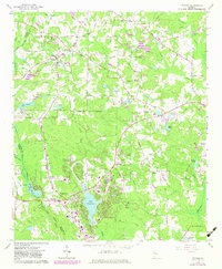
1965 Map of Tyrone
USGS Topo · Published 1983About this map
Peachtree City and the surrounding Fayette County landscape are captured during a significant period of residential and infrastructure expansion in the early 1980s. The map illustrates the emerging street patterns and water features that define this planned community, centered around Lake Peachtree and the adjacent Golf Course. To the north, the town of Tyrone sits along the Seaboard Coast Line railroad, surrounded by numerous private lakes and ponds such as Lake Tyrone, Adams Lake, and Farrs Lake.
Find a feature on this map
60 named features on this map. Tap any name to fly to it.
Don’t see what you’re looking for? This feature index may not catch every label — zoom into the map to look around manually.
Map Details
Editions of this 1965 Tyrone Map
2 editions found

Other maps of this area

1888 · Atlanta
USGS Topo · 1:125,000

1890 · Atlanta
USGS Topo · 1:125,000

1891 · Marietta
USGS Topo · 1:125,000

1892 · Atlanta
USGS Topo · 1:125,000

1895 · Atlanta
USGS Topo · 1:125,000

1895 · Marietta
USGS Topo · 1:125,000

1897 · Marietta
USGS Topo · 1:125,000

1901 · Marietta
USGS Topo · 1:125,000

1953 · Atlanta
USGS Topo · 1:250,000

1954 · Palmetto
USGS Topo · 1:24,000