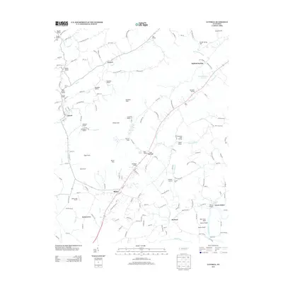
2013 Map of Luttrell
USGS Topo · Published 2013About this map
Blaine and Luttrell anchor this 2013 survey of the Tennessee landscape, where the ridge-and-valley topography of the Clinch Mountain area dictates the path of local life. The map details the transition from high points like Kitts Point and Wildcat Spur down into settled pockets such as Lea Springs and Chesney. Along the southern edge, the Holston River serves as a primary geographic boundary, featuring historical crossing points like Nance Ferry and Mitchell Ford. The presence of Melton Field Airport and the cluster of family-named settlements like Zacharytown and Needham Hollow illustrate a rural community where modern infrastructure meets generations-old land divisions. From the headwaters of Bullrun Cr to the broad expanse of Richland Valley, the map documents the intricate network of local roads—such as Texas Hollow Rd and Joppa Mountain Rd—that lace through the hollows and gaps of Grainger County.
Find a feature on this map
168 named features on this map. Tap any name to fly to it.
Don’t see what you’re looking for? This feature index may not catch every label — zoom into the map to look around manually.
Map Details
Editions of this 2013 Luttrell Map
This is the sole edition of this map. No revisions or reprints were ever made.
Other maps of this area

1897 · Maynardville
USGS Topo · 1:125,000

1900 · Maynardville
USGS Topo · 1:125,000

1935 · Luttrell
USGS Topo · 1:24,000

1935 · Mascot
USGS Topo · 1:24,000

1935 · Straw Plains
USGS Topo · 1:48,000

1935 · Graveston
USGS Topo · 1:24,000

1935 · Joppa
USGS Topo · 1:24,000
1935 · New Market
USGS Topo · 1:24,000

1936 · Gorryton
USGS Topo · 1:48,000

1936 · Powder Springs
USGS Topo · 1:24,000