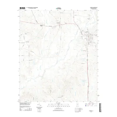
2014 Map of Luverne
USGS Topo · Published 2014About this map
Luverne and its surrounding countryside in central Alabama are defined by the winding course of Patsaliga Creek and its many tributaries. This 2014 survey reveals a landscape where modern infrastructure like Frank Sikes Airport exists alongside long-established local landmarks and burial grounds. Genealogists can locate several community cemeteries, including Emmaus Cem on the eastern edge of town and Siloam Cem near the northwestern corner. The settlement pattern follows the local topography, with Rutledge and Cherokee Village positioned along the major east-west corridor of Al-10. South of the main settlements, the terrain becomes more water-dominant, featuring Crenshaw County Public Lake, Morris Pond, and Halls Pond. The extensive network of local roads, such as Siloam Church Rd and Swanner Bridge Rd, highlights the connectivity between rural homesteads and the county's municipal centers.
Find a feature on this map
84 named features on this map. Tap any name to fly to it.
Don’t see what you’re looking for? This feature index may not catch every label — zoom into the map to look around manually.
Map Details
Editions of this 2014 Luverne Map
This is the sole edition of this map. No revisions or reprints were ever made.
Other maps of this area

1953 · Andalusia
USGS Topo · 1:250,000

1957 · Andalusia
USGS Topo · 1:250,000

1968 · Glenwood
USGS Topo · 1:24,000

1968 · Bullock
USGS Topo · 1:24,000

1968 · Petrey
USGS Topo · 1:24,000

1971 · Luverne
USGS Topo · 1:24,000

1971 · Brantley
USGS Topo · 1:24,000

1971 · Fullers Crossroads
USGS Topo · 1:24,000

1971 · Honoraville
USGS Topo · 1:24,000

1971 · Leon
USGS Topo · 1:24,000