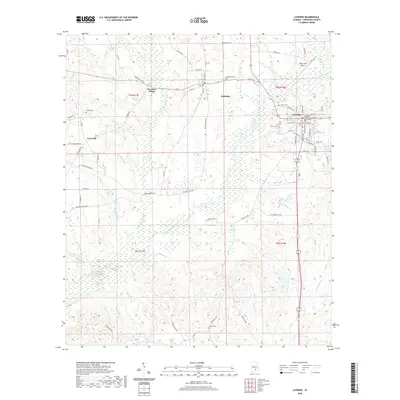
2020 Map of Luverne
USGS Topo · Published 2020About this map
The Crenshaw County Courthouse stands as a central landmark in Luverne, anchoring a region defined by the winding course of Patsaliga Creek and its many tributaries. This landscape transition from the town center to the outlying settlements of Rutledge and Cherokee Village reflects the rural character of south-central Alabama. The terrain is intricately etched by waterways like Little Patsaliga Cr, Siloam Cr, and Sikes Mill Cr, which suggest a history of water-powered industry and early agricultural development. Genealogists and local historians will find significant value in the distribution of family and community burial grounds, including Rutledge Cem, Siloam Cem, Green Cem, and Clarke Cem. From the aviation facilities at Frank Sikes Airport to the rural crossings at Swanner Bridge Rd, the map documents a community where modern infrastructure meets long-established drainage patterns and land divisions.
Find a feature on this map
83 named features on this map. Tap any name to fly to it.
Don’t see what you’re looking for? This feature index may not catch every label — zoom into the map to look around manually.
Map Details
Editions of this 2020 Luverne Map
This is the sole edition of this map. No revisions or reprints were ever made.
Other maps of this area

1953 · Andalusia
USGS Topo · 1:250,000

1957 · Andalusia
USGS Topo · 1:250,000

1968 · Glenwood
USGS Topo · 1:24,000

1968 · Bullock
USGS Topo · 1:24,000

1968 · Petrey
USGS Topo · 1:24,000

1971 · Luverne
USGS Topo · 1:24,000

1971 · Brantley
USGS Topo · 1:24,000

1971 · Fullers Crossroads
USGS Topo · 1:24,000

1971 · Honoraville
USGS Topo · 1:24,000

1971 · Leon
USGS Topo · 1:24,000