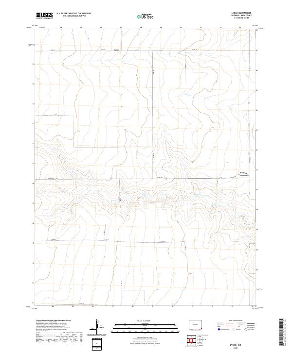
2022 Map of Lycan
USGS Topo · Published 2022About this map
Lycan and Buckeye Crossroads anchor this rural landscape in eastern Baca County, where the high plains are defined by an expansive grid of section lines and gravel roads. The terrain is marked by the winding paths of Buffalo Cr and Beaty Cr, which cut through the agricultural surroundings of T28S R43W and T28S R42W. This 2022 survey illustrates the modern transportation network, centered on key junctions like Co Rd RR and Co Rd VV. The map provides a clear view of the sparse settlement patterns typical of this region, where small communities and named crossroads remain the primary landmarks across the wide, open reaches of southeastern Colorado.
Find a feature on this map
19 named features on this map. Tap any name to fly to it.
Don’t see what you’re looking for? This feature index may not catch every label — zoom into the map to look around manually.
Map Details
Editions of this 2022 Lycan Map
This is the sole edition of this map. No revisions or reprints were ever made.
Other maps of this area

1891 · Albany
USGS Topo · 1:125,000

1892 · Vilas
USGS Topo · 1:125,000

1893 · Albany
USGS Topo · 1:125,000

1955 · La Junta
USGS Topo · 1:250,000

1958 · La Junta
USGS Topo · 1:250,000

1968 · La Junta
USGS Topo · 1:250,000
1971 · Lycan SE
USGS Topo · 1:24,000
1971 · Lycan NE
USGS Topo · 1:24,000
1971 · Plains Community
USGS Topo · 1:24,000

1971 · Two Buttes SE
USGS Topo · 1:24,000