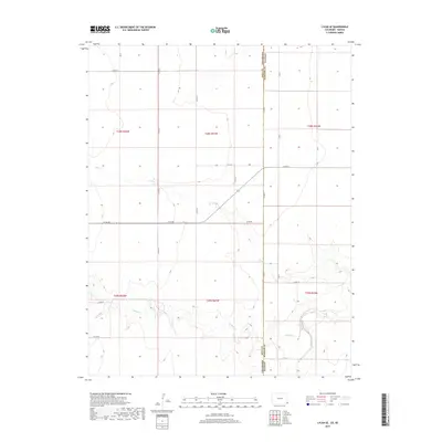
2019 Map of Lycan SE
USGS Topo · Published 2019About this map
Baca and Stanton counties meet along a section of the state line where the high plains are carved by seasonal watercourses. This landscape is defined by the drainage patterns of Beaty Cr in the north and the more prominent Buffalo Cr to the south. These creek beds create the primary relief in an otherwise strictly gridded agricultural territory, partitioned by the Public Land Survey System into townships like t28s r41w and t29s r42w. A sparse but systematic network of section-line roads, such as Co Rd RR and Co RD 54, provides the only infrastructure across these expansive reaches. The map illustrates the intersection of geopolitical boundaries and natural geography, where Bear Creek crosses from Colorado into Kansas, influencing the local topography and the orientation of rural access routes.
Find a feature on this map
26 named features on this map. Tap any name to fly to it.
Don’t see what you’re looking for? This feature index may not catch every label — zoom into the map to look around manually.
Map Details
Editions of this 2019 Lycan SE Map
This is the sole edition of this map. No revisions or reprints were ever made.
Other maps of this area

1891 · Albany
USGS Topo · 1:125,000

1892 · Vilas
USGS Topo · 1:125,000

1893 · Albany
USGS Topo · 1:125,000

1900 · Syracuse
USGS Topo · 1:125,000

1920 · Syracuse
USGS Topo · 1:125,000

1955 · La Junta
USGS Topo · 1:250,000

1955 · Dodge City
USGS Topo · 1:250,000

1958 · La Junta
USGS Topo · 1:250,000

1958 · Dodge City
USGS Topo · 1:250,000

1959 · Dodge City
USGS Topo · 1:250,000