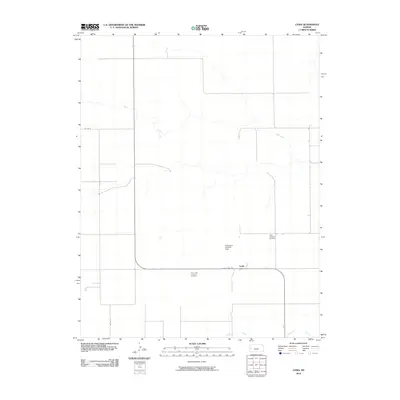
2010 Map of Lydia
USGS Topo · Published 2010About this map
Lydia serves as the focal point of this rural Wichita County landscape, where the agricultural grid is defined by a sparse but significant network of local roads and waterways. This 2010 survey illustrates a quiet prairie environment where community identity is preserved through its religious and commemorative sites, specifically the Lydia Lutheran Cemetery and Zion Lydia Lutheran Cemetery. The presence of the Kuhlmann Landing Field near the settlement suggests the continued importance of private aviation in managing the expansive Western Kansas terrain. Water management and drainage are traced through the ephemeral paths of Sand Creek and Campbell Draw, which cut across the high plains. The area is connected to the wider region by State Hwy 25, providing a modern link for this small, agrarian community.
Find a feature on this map
10 named features on this map. Tap any name to fly to it.
Don’t see what you’re looking for? This feature index may not catch every label — zoom into the map to look around manually.
Map Details
Editions of this 2010 Lydia Map
This is the sole edition of this map. No revisions or reprints were ever made.
Other maps of this area

1941 · Modoc
USGS Topo · 1:62,500

1951 · Modoc
USGS Topo · 1:62,500

1955 · Scott City
USGS Topo · 1:250,000

1958 · Scott City
USGS Topo · 1:250,000

1965 · Leoti 3 NW
USGS Topo · 1:24,000

1965 · Leoti 3 NE
USGS Topo · 1:24,000

1965 · Wolf NW
USGS Topo · 1:24,000

1970 · Leoti
USGS Topo · 1:24,000

1970 · Lydia
USGS Topo · 1:24,000

1970 · Leoti NW
USGS Topo · 1:24,000