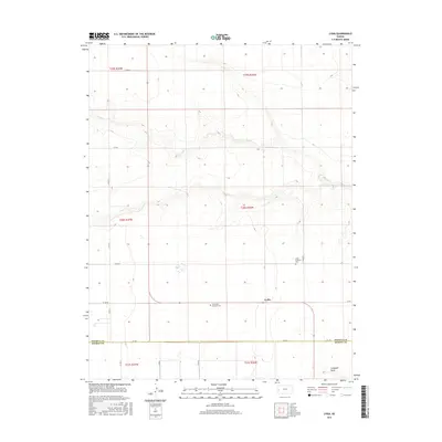
2015 Map of Lydia
USGS Topo · Published 2015About this map
The small community of Lydia sits in the high plains of western Kansas, where the survey lines of the Public Land Survey System define the movement of modern county roads. This prairie landscape is primarily shaped by the meandering path of Sand Cr, which cuts through the northern sections, and the topographic depression of Campbell Draw to the south. Life in this corner of Wichita County is centered on the intersection of Co RD 1 and Co RD CC, where the spiritual and genealogical history of the area is preserved at the Lydia Lutheran Cem and the Zion Lydia Lutheran Cem. The map clearly delineates the border between Wichita and Kearny counties, following the alignment of RD 370.
Find a feature on this map
25 named features on this map. Tap any name to fly to it.
Don’t see what you’re looking for? This feature index may not catch every label — zoom into the map to look around manually.
Map Details
Editions of this 2015 Lydia Map
This is the sole edition of this map. No revisions or reprints were ever made.
Other maps of this area

1941 · Modoc
USGS Topo · 1:62,500

1951 · Modoc
USGS Topo · 1:62,500

1955 · Scott City
USGS Topo · 1:250,000

1958 · Scott City
USGS Topo · 1:250,000

1965 · Leoti 3 NW
USGS Topo · 1:24,000

1965 · Leoti 3 NE
USGS Topo · 1:24,000

1965 · Wolf NW
USGS Topo · 1:24,000

1970 · Leoti
USGS Topo · 1:24,000

1970 · Lydia
USGS Topo · 1:24,000

1970 · Leoti NW
USGS Topo · 1:24,000