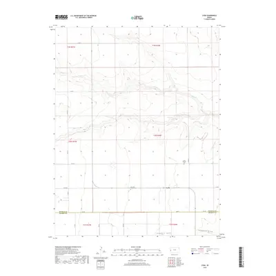
2018 Map of Lydia
USGS Topo · Published 2018About this map
Lydia serves as the central focal point for this section of the High Plains, situated in a landscape defined by the drainage of Sand Cr and the topographical depression of Campbell Draw. The settlement pattern reflects the grid-based agricultural development of western Kansas, where road networks such as Co RD 12 and Co RD CC partition the expansive terrain. For genealogists and local historians, the presence of the Lydia Lutheran Cem and Zion Lydia Lutheran Cem provides specific points of interest related to the community's heritage. The map also delineates the jurisdictional boundary between Wichita Co and Kearny Co, illustrating how these remote rural areas are organized across the county line.
Find a feature on this map
23 named features on this map. Tap any name to fly to it.
Don’t see what you’re looking for? This feature index may not catch every label — zoom into the map to look around manually.
Map Details
Editions of this 2018 Lydia Map
This is the sole edition of this map. No revisions or reprints were ever made.
Other maps of this area

1941 · Modoc
USGS Topo · 1:62,500

1951 · Modoc
USGS Topo · 1:62,500

1955 · Scott City
USGS Topo · 1:250,000

1958 · Scott City
USGS Topo · 1:250,000

1965 · Leoti 3 NW
USGS Topo · 1:24,000

1965 · Leoti 3 NE
USGS Topo · 1:24,000

1965 · Wolf NW
USGS Topo · 1:24,000

1970 · Leoti
USGS Topo · 1:24,000

1970 · Lydia
USGS Topo · 1:24,000

1970 · Leoti NW
USGS Topo · 1:24,000