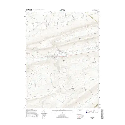
2016 Map of Lykens
USGS Topo · Published 2016About this map
Lykens and Wiconisco serve as central nodes in this valley landscape, where the residential grids of the two settlements sit tightly between the southern slopes of Short Mtn and the northern face of Berry Mtn. The geography is defined by the east-west corridor of Wiconisco Creek, which provides a natural path for Railroad St and Pottsville St to connect these communities. The southern half of the map is dominated by the ridges of Broad Mountain and Peters Mtn, separated by the drainage basins of Rattling Creek and Stone Cabin Run. This area contains numerous family-named and topographic landmarks such as Doc Smith Run and Spechty Kopf. Farther north, the borough of Gratz sits on more level ground near the headwaters of several runs, while local history is marked by institutions like the Calvary Cem and the Fairview Sch.
Find a feature on this map
107 named features on this map. Tap any name to fly to it.
Don’t see what you’re looking for? This feature index may not catch every label — zoom into the map to look around manually.
Map Details
Editions of this 2016 Lykens Map
This is the sole edition of this map. No revisions or reprints were ever made.
Other maps of this area

1892 · Lykens
USGS Topo · 1:62,500

1892 · Hummelstown
USGS Topo · 1:62,500

1892 · Harrisburg
USGS Topo · 1:62,500

1893 · Lykens
USGS Topo · 1:62,500

1893 · Millersburg
USGS Topo · 1:62,500

1899 · Harrisburg
USGS Topo · 1:62,500

1924 · Hummelstown
USGS Topo · 1:62,500

1924 · Harrisburg
USGS Topo · 1:62,500

1943 · Millersburg
USGS Topo · 1:62,500

1943 · Lykens
USGS Topo · 1:62,500