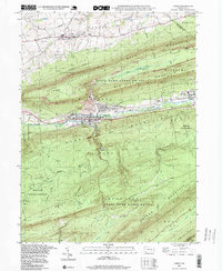
1997 Map of Lykens
USGS Topo · Published 1999About this map
The borough of Lykens and the neighboring settlement of Wiconisco occupy the narrow valley floor between Berry Mountain and Big Lick Mountain, showing a landscape defined by its anthracite coal mining legacy. Large areas of strip mines, tailings, and a tailings pond dominate the slopes of Big Lick Mountain, reflecting the intensive industrial activity of this corner of the Coal Region. To the north, the town of Gratz sits on more level terrain near the Fairgrounds and a drive-in theater, illustrating the shift from industrial centers to agricultural and commercial spaces.
Find a feature on this map
63 named features on this map. Tap any name to fly to it.
Don’t see what you’re looking for? This feature index may not catch every label — zoom into the map to look around manually.
Map Details
Editions of this 1997 Lykens Map
This is the sole edition of this map. No revisions or reprints were ever made.
Other maps of this area

1892 · Lykens
USGS Topo · 1:62,500

1892 · Hummelstown
USGS Topo · 1:62,500

1892 · Harrisburg
USGS Topo · 1:62,500

1893 · Lykens
USGS Topo · 1:62,500

1893 · Millersburg
USGS Topo · 1:62,500

1899 · Harrisburg
USGS Topo · 1:62,500

1924 · Hummelstown
USGS Topo · 1:62,500

1924 · Harrisburg
USGS Topo · 1:62,500

1943 · Millersburg
USGS Topo · 1:62,500

1943 · Lykens
USGS Topo · 1:62,500