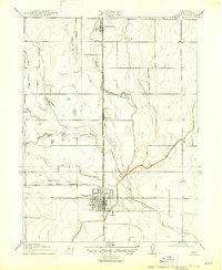
1917 Map of Lyman
USGS Topo · Published 1947About this map
Willows serves as the primary hub of this Glenn County agricultural landscape during the early twentieth century. The town is defined by a dense grid of streets and a critical nexus of rail lines, reflecting its role as a regional center for transit and trade. The Southern Pacific (Woodland Line) runs north-south through the territory, connecting the community of Lyman and the settlement of Germantown to the broader California rail network. To the west, the Fruto Branch extends toward the foothills, while the Central Pacific also traverses the area.
Find a feature on this map
13 named features on this map. Tap any name to fly to it.
Don’t see what you’re looking for? This feature index may not catch every label — zoom into the map to look around manually.
Map Details
Editions of this 1917 Lyman Map
2 editions found
Other maps of this area

1904 · Walker Creek
USGS Topo · 1:31,680

1904 · Logan Creek
USGS Topo · 1:24,000

1906 · Maxwell
USGS Topo · 1:62,500

1906 · Willows
USGS Topo · 1:62,500

1914 · Orland
USGS Topo · 1:31,680

1914 · Hamilton
USGS Topo · 1:31,680

1917 · Kurand
USGS Topo · 1:31,680

1917 · Lyman
USGS Topo · 1:31,680

1917 · Jacinto
USGS Topo · 1:31,680

1917 · Logandale
USGS Topo · 1:31,680