
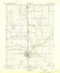
1917 Map of Lyman
USGS Topo · Published 1917About this map
Willows serves as the primary hub of this 1917 survey, showcasing a grid of streets and blocks at the intersection of several rail routes. The Southern Pacific tracks provide the central axis, with the Woodland Line and the Fruto Branch extending west into the agricultural landscape. This era marks a significant period of water management in Glenn County, evidenced by the prominent Irrigation Canal that cuts across the terrain to support local farming operations.
Find a feature on this map
14 named features on this map. Tap any name to fly to it.
Don’t see what you’re looking for? This feature index may not catch every label — zoom into the map to look around manually.
Map Details
Editions of this 1917 Lyman Map
2 editions found
Other maps of this area

1904 · Walker Creek
USGS Topo · 1:31,680

1904 · Logan Creek
USGS Topo · 1:24,000

1906 · Maxwell
USGS Topo · 1:62,500

1906 · Willows
USGS Topo · 1:62,500

1914 · Orland
USGS Topo · 1:31,680

1914 · Hamilton
USGS Topo · 1:31,680

1917 · Kurand
USGS Topo · 1:31,680

1917 · Jacinto
USGS Topo · 1:31,680

1917 · Logandale
USGS Topo · 1:31,680

1918 · Logan Creek
USGS Topo · 1:31,680