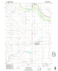
1990 Map of Lyman
USGS Topo · Published 1995About this map
Lyman sits at the heart of an intricate irrigation network in the Nebraska panhandle, where the high plains transition into the North Platte River valley. This landscape is defined by the legacy of western movement and agricultural engineering, featuring the Emigrant Trail cutting across the northern reaches near Henry. The map illustrates a complex hydraulic system necessary for farming this arid region, including the Farmers Canal, Gering-Mitchell Canal, and numerous laterals like the Springer Main Lateral.
Find a feature on this map
35 named features on this map. Tap any name to fly to it.
Don’t see what you’re looking for? This feature index may not catch every label — zoom into the map to look around manually.
Map Details
Editions of this 1990 Lyman Map
This is the sole edition of this map. No revisions or reprints were ever made.
Other maps of this area

1896 · Patrick
USGS Topo · 1:125,000

1898 · Scotts Bluff
USGS Topo · 1:125,000

1899 · Goshen Hole
USGS Topo · 1:125,000

1899 · Whistle Creek
USGS Topo · 1:125,000

1954 · Scottsbluff
USGS Topo · 1:250,000

1954 · Torrington
USGS Topo · 1:250,000

1954 · Cheyenne
USGS Topo · 1:250,000

1955 · Alliance
USGS Topo · 1:250,000

1957 · Alliance
USGS Topo · 1:250,000

1958 · Cheyenne
USGS Topo · 1:250,000