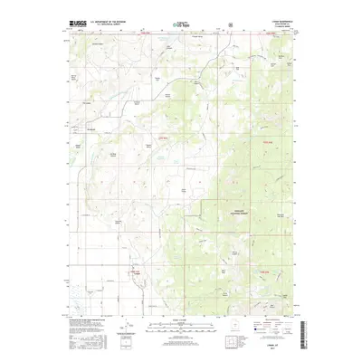
2017 Map of Lyman
USGS Topo · Published 2017About this map
The Fremont River valley defines the western reach of this survey, supporting the small rural settlements of Fremont and Lyman. The local economy is visibly tied to the management of water and terrain, evidenced by the High Line Ditch and numerous irrigation-dependent sites like Tidwell Reservoir and Mill Meadow Reservoir. To the east, the landscape rises dramatically into the Fishlake National Forest, where the terrain is marked by prominent geological features such as Thousand Lake Mtn and the Yellow Ledges. This area is a patchwork of grazing lands and drainage basins, with named features like Horse Pasture and Sage Flat indicating traditional land use. Genealogists may find interest in the precise location of the Lyman Cem situated just west of the town center, while local historians can trace the network of forest trails and roads, including the Red Canyon Rd and Tidwell Rd, that connected these mountain flats to the valley floor.
Find a feature on this map
62 named features on this map. Tap any name to fly to it.
Don’t see what you’re looking for? This feature index may not catch every label — zoom into the map to look around manually.
Map Details
Editions of this 2017 Lyman Map
This is the sole edition of this map. No revisions or reprints were ever made.
Other maps of this area

1885 · Fish Lake
USGS Topo · 1:250,000

1896 · Fish Lake
USGS Topo · 1:250,000

1952 · Notom 2 NW
USGS Topo · 1:24,000

1952 · Loa 1 SE
USGS Topo · 1:24,000

1952 · Notom 2 SW
USGS Topo · 1:24,000

1952 · Torrey
USGS Topo · 1:62,500

1952 · Loa 1 NE
USGS Topo · 1:24,000

1956 · Salina
USGS Topo · 1:250,000

1960 · Salina
USGS Topo · 1:250,000

1962 · Salina
USGS Topo · 1:250,000