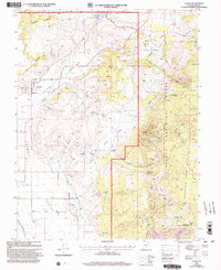
2001 Map of Lyman
USGS Topo · Published 2003About this map
Lyman and Fremont occupy the valley floor in this 2001 revision, where the Fremont River winds through agricultural lands and small-scale infrastructure like the Highline Ditch. The landscape is defined by the dramatic ascent from Rabbit Valley into the high country of the Fishlake National Forest and the towering heights of Thousand Lake Mountain. This survey highlights the critical role of water management in this arid region, showing the Mill Meadow Reservoir and Tidwell Reservoir alongside a network of springs such as Tidwell Spring and Cedar Creek Spring. Traces of local industry and community life are visible in the Gravel Pit near Tidwell Valley and the Cem located south of the main settlements. The transition from the flatlands of Teddee Flat and Sage Flat to the complex topography of The Ledges illustrates the diverse terrain that shapes Wayne County's high-plateau environment.
Find a feature on this map
47 named features on this map. Tap any name to fly to it.
Don’t see what you’re looking for? This feature index may not catch every label — zoom into the map to look around manually.
Map Details
Editions of this 2001 Lyman Map
This is the sole edition of this map. No revisions or reprints were ever made.
Other maps of this area

1885 · Fish Lake
USGS Topo · 1:250,000

1896 · Fish Lake
USGS Topo · 1:250,000

1952 · Notom 2 NW
USGS Topo · 1:24,000

1952 · Loa 1 SE
USGS Topo · 1:24,000

1952 · Notom 2 SW
USGS Topo · 1:24,000

1952 · Torrey
USGS Topo · 1:62,500

1952 · Loa 1 NE
USGS Topo · 1:24,000

1956 · Salina
USGS Topo · 1:250,000

1960 · Salina
USGS Topo · 1:250,000

1962 · Salina
USGS Topo · 1:250,000