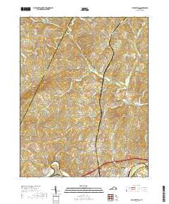
2019 Map of Lynch Station
USGS Topo · Published 2019About this map
Altavista and Lynch Station anchor the southern portion of this landscape where the Norfolk Southern rail line follows the northern bank of the Roanoke River. The terrain is defined by a dense network of tributaries, including Big Otter River, Buffalo Cr, and Tardy Br, which carve through the Piedmont hills. This 2019 survey documents the rural character of southern Campbell County, marked by scattered family and community sites like Vaughn Cem and Mount Hermon Cem. To the north, the settlement of Evington sits amidst a series of prominent elevations, including Johnson Mtn and Haden Mtn. The map clearly delineates the county boundaries between Bedford and Pittsylvania, illustrating how the waterways and ridges have historically influenced the division of these Virginia lands.
Find a feature on this map
88 named features on this map. Tap any name to fly to it.
Don’t see what you’re looking for? This feature index may not catch every label — zoom into the map to look around manually.
Map Details
Editions of this 2019 Lynch Station Map
This is the sole edition of this map. No revisions or reprints were ever made.
Other maps of this area

1892 · Lynchburg
USGS Topo · 1:125,000

1944 · Lynchburg
USGS Topo · 1:62,500

1947 · Roanoke
USGS Topo · 1:250,000

1950 · Goode
USGS Topo · 1:62,500

1950 · Lynchburg
USGS Topo · 1:62,500

1951 · Altavista
USGS Topo · 1:62,500

1956 · Gladys
USGS Topo · 1:62,500

1959 · Roanoke
USGS Topo · 1:250,000

1963 · Roanoke
USGS Topo · 1:250,000

1963 · City Farm
USGS Topo · 1:24,000