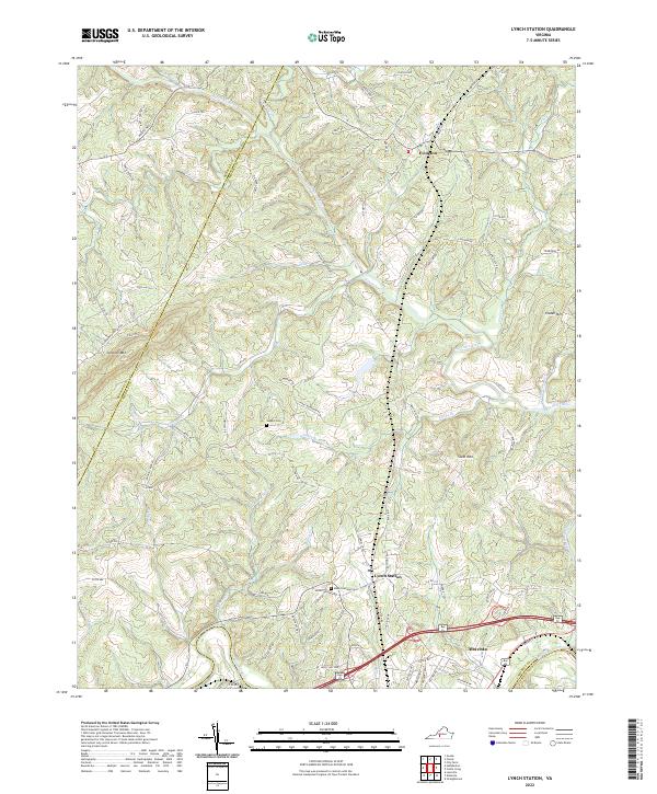
2022 Map of Lynch Station
USGS Topo · Published 2022About this map
Lynch Station and the neighboring community of Evington are central to this Piedmont landscape, which is defined by the winding course of the Big Otter River as it moves toward its confluence with the Roanoke River near Altavista. The terrain is characterized by prominent elevations such as Scott Mtn and Johnson Mtn, interspersed with a dense network of watercourses including Troublesome Cr and Pocket Cr. This modern survey reveals a region where traditional land use patterns persist alongside modern development, particularly visible in the road networks branching from Main St. Genealogists may find particular value in the documentation of local burial grounds like Mount Hermon Cem and the Vaughn Cem, which anchor the area's rural history. The map also clearly delineates the administrative boundary between Bedford Co and Campbell Co, following the ridgelines and stream valleys that have long shaped local boundaries.
Find a feature on this map
85 named features on this map. Tap any name to fly to it.
Don’t see what you’re looking for? This feature index may not catch every label — zoom into the map to look around manually.
Map Details
Editions of this 2022 Lynch Station Map
This is the sole edition of this map. No revisions or reprints were ever made.
Other maps of this area

1892 · Lynchburg
USGS Topo · 1:125,000

1944 · Lynchburg
USGS Topo · 1:62,500

1947 · Roanoke
USGS Topo · 1:250,000

1950 · Goode
USGS Topo · 1:62,500

1950 · Lynchburg
USGS Topo · 1:62,500

1951 · Altavista
USGS Topo · 1:62,500

1956 · Gladys
USGS Topo · 1:62,500

1959 · Roanoke
USGS Topo · 1:250,000

1963 · Roanoke
USGS Topo · 1:250,000

1963 · City Farm
USGS Topo · 1:24,000