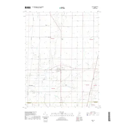
2019 Map of Lynn
USGS Topo · Published 2019About this map
The town of Lynn serves as the central hub of this eastern Indiana landscape, where the agricultural grid is etched with historical cemeteries and a dense network of small waterways. Local history is anchored by sites like Quaker Lynn Cem and Cherry Grove Cem, while the headwaters of the White River and Greens Fork define the drainage of the region. The map captures the quiet transition between the settlements of Rural to the north and Bloomingport to the southwest. A legacy of early surveying and land division is evident in the persistent use of names like S Base Rd and S Boundary Pike. The terrain is characterized by subtle features such as Snow Hill and an intricate system of agricultural ditches including Colvin Ditch and Hinshall Ditch, illustrating the intensive management of this fertile countryside for generational farming.
Find a feature on this map
101 named features on this map. Tap any name to fly to it.
Don’t see what you’re looking for? This feature index may not catch every label — zoom into the map to look around manually.
Map Details
Editions of this 2019 Lynn Map
This is the sole edition of this map. No revisions or reprints were ever made.
Other maps of this area

1915 · New Paris
USGS Topo · 1:48,000

1916 · Winchester
USGS Topo · 1:48,000

1918 · Winchester
USGS Topo · 1:62,500

1918 · New Paris
USGS Topo · 1:62,500

1943 · Winchester
USGS Topo · 1:62,500

1952 · Maxville
USGS Topo · 1:24,000

1953 · Cincinnati
USGS Topo · 1:250,000

1953 · Muncie
USGS Topo · 1:250,000

1956 · Muncie
USGS Topo · 1:250,000

1957 · Cincinnati
USGS Topo · 1:250,000