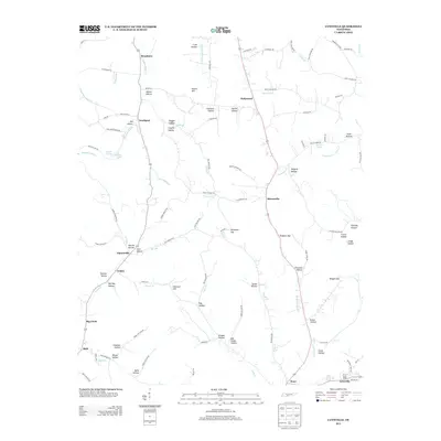
2013 Map of Lynnville
USGS Topo · Published 2013About this map
Lynnville anchor's the southeastern corner of this Tennessee landscape, where the local terrain is defined by a dense network of named hollows and creek branches. Smaller communities like Southport, Stiversville, and Waco serve as historic nodes within a countryside carved by Fountain Cr and the E Fork Little Bigby Cr. For genealogists and local historians, the numerous family-named landmarks—such as Gilmer Hollow, Ingram Hollow, and Evans Hollow—provide a clear record of long-standing land tenures. Transportation patterns are centered on routes like Mooresville Pike and the various hollow roads that trace the natural contours of the land. Water sources like Ingram Spring and Badget Spring appear alongside larger features such as Millers Lake, illustrating the essential connection between water access and settlement in this part of Giles County.
Find a feature on this map
109 named features on this map. Tap any name to fly to it.
Don’t see what you’re looking for? This feature index may not catch every label — zoom into the map to look around manually.
Map Details
Editions of this 2013 Lynnville Map
This is the sole edition of this map. No revisions or reprints were ever made.
Other maps of this area

1901 · Colombia
USGS Topo · 1:125,000

1936 · Sandy Hook
USGS Topo · 1:24,000

1936 · Milky Way
USGS Topo · 1:24,000

1936 · Campbellsville
USGS Topo · 1:24,000

1936 · Brick Church
USGS Topo · 1:24,000

1936 · Campbells Station
USGS Topo · 1:24,000

1936 · Mount Pleasant
USGS Topo · 1:24,000

1936 · Glendale
USGS Topo · 1:24,000

1936 · Columbia
USGS Topo · 1:24,000

1936 · Lynnville
USGS Topo · 1:24,000