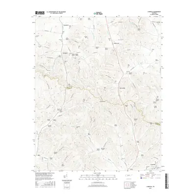
2016 Map of Lynnville
USGS Topo · Published 2016About this map
Elk Ridge serves as the prominent divider across this landscape on the border of Maury and Giles counties, where numerous hollows and gaps dictate the pattern of rural settlement. Small communities like Stiversville, Yokley, and Southport are connected by a network of winding roads such as Yokley Rd and Stiversville Rd. The map reveals a dense concentration of family and local burial sites, providing a significant resource for genealogical research. Features such as the Old Camping Ground Cem, West Family Cem, and New Ramey Cem are preserved alongside larger sites like Lynnwood Cem. The drainage of the area is defined by Little Bigby Cr and Fountain Cr, which cut through the ridges and created the named gaps like Hickmans Gap and Nubbins Gap that have historically channeled travel through the Tennessee hills.
Find a feature on this map
128 named features on this map. Tap any name to fly to it.
Don’t see what you’re looking for? This feature index may not catch every label — zoom into the map to look around manually.
Map Details
Editions of this 2016 Lynnville Map
This is the sole edition of this map. No revisions or reprints were ever made.
Other maps of this area

1901 · Colombia
USGS Topo · 1:125,000

1936 · Sandy Hook
USGS Topo · 1:24,000

1936 · Milky Way
USGS Topo · 1:24,000

1936 · Campbellsville
USGS Topo · 1:24,000

1936 · Brick Church
USGS Topo · 1:24,000

1936 · Campbells Station
USGS Topo · 1:24,000

1936 · Mount Pleasant
USGS Topo · 1:24,000

1936 · Glendale
USGS Topo · 1:24,000

1936 · Columbia
USGS Topo · 1:24,000

1936 · Lynnville
USGS Topo · 1:24,000