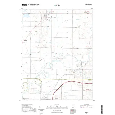
2019 Map of Lyons
USGS Topo · Published 2019About this map
The White River carves a winding path through the heart of Greene and Daviess counties, defining a landscape shaped by both natural riparian movement and an intensive drainage network. Settled areas like Lyons, Newberry, and Elnora are connected by a grid of rural roads and the Indiana Rail Road, reflecting the region's agricultural foundations. The terrain is punctuated by distinctive river features such as Dog Island and Birch Bed, while local family and community history is preserved in numerous burial grounds, including the uniquely named Old Stinkard Cem and Mount Zion Cem. Drainage projects like Beehunter Ditch and Timmons Ditch illustrate the long-term engineering required to manage the low-lying bottomlands for cultivation. To the east, elevations rise slightly toward Simpson Hill and Maumee Hill, providing a subtle contrast to the broad river valley that dominates the central portion of this survey.
Find a feature on this map
77 named features on this map. Tap any name to fly to it.
Don’t see what you’re looking for? This feature index may not catch every label — zoom into the map to look around manually.
Map Details
Editions of this 2019 Lyons Map
This is the sole edition of this map. No revisions or reprints were ever made.
Other maps of this area

1908 · Bloomfield
USGS Topo · 1:62,500

1938 · Switz City
USGS Topo · 1:24,000

1940 · Linton
USGS Topo · 1:24,000

1943 · Lyons
USGS Topo · 1:24,000

1943 · Sandborn
USGS Topo · 1:24,000

1943 · Plainville
USGS Topo · 1:24,000

1943 · Epsom
USGS Topo · 1:24,000

1947 · Switz City
USGS Topo · 1:24,000

1947 · Linton
USGS Topo · 1:24,000

1950 · Switz City
USGS Topo · 1:24,000