2022 Map of Lyons
USGS Topo · Published 2022About this map
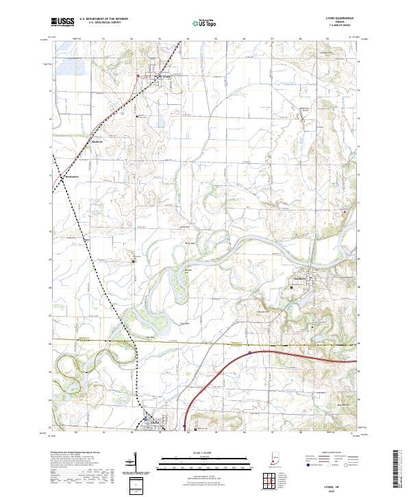
The White River winds through a landscape defined by expansive bottomlands and an intricate network of drainage channels in this 2022 survey of Greene, Knox, and Daviess Counties. The terrain is marked by distinctive named beds such as Long Bed, Birch Bed, and Sipes Bed, which sit alongside prominent elevations like Morgan Hill and Brewer Hill. This region is a study in early 21st-century agricultural land management, where numerous ditches including Beehunter Ditch and Timmons Ditch channel water away from fertile fields toward the river.
Find a feature on this map
68 named features on this map. Tap any name to fly to it.
Don’t see what you’re looking for? This feature index may not catch every label — zoom into the map to look around manually.
Map Details
Editions of this 2022 Lyons Map
This is the sole edition of this map. No revisions or reprints were ever made.
Historical Maps of Ilene Through Time
4 maps found