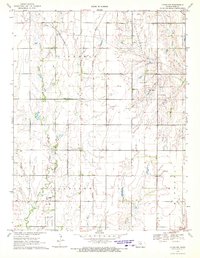
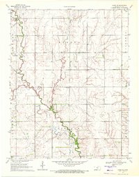
1970 Map of Lyons NW
USGS Topo · Published 1972About this map
Little Cow Creek and the Little Arkansas River meander through this rural section of Rice County, defining a landscape shaped by both agriculture and energy extraction. The map documents the intricate network of the Geneseo Oil and Gas Field and the Kepley Oil Field, where numerous well sites and a complex Pipeline infrastructure overlay the section lines. This era of Kansas history is captured through the presence of the St Louis-San Francisco and Missouri Pacific railroads, which once facilitated the movement of local resources.
Find a feature on this map
14 named features on this map. Tap any name to fly to it.
Don’t see what you’re looking for? This feature index may not catch every label — zoom into the map to look around manually.
Map Details
Editions of this 1970 Lyons NW Map
This is the sole edition of this map. No revisions or reprints were ever made.
Other maps of this area

1894 · Ellsworth
USGS Topo · 1:125,000

1894 · Lyons
USGS Topo · 1:125,000

1955 · Great Bend
USGS Topo · 1:250,000

1957 · Great Bend
USGS Topo · 1:250,000

1958 · Great Bend
USGS Topo · 1:250,000
1964 · Crawford
USGS Topo · 1:24,000
1964 · Geneseo
USGS Topo · 1:24,000
1964 · Lorraine
USGS Topo · 1:24,000

1970 · Lyons
USGS Topo · 1:24,000
1970 · Chase NE
USGS Topo · 1:24,000