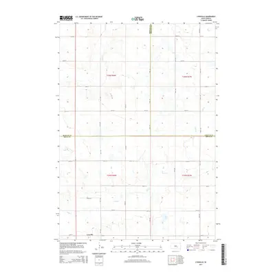
2015 Map of Lyonville
USGS Topo · Published 2015About this map
Lyonville sits at the southwestern edge of a vast agricultural landscape defined by the intersection of three counties. This survey captures the rural layout where Buffalo, Brule, and Jerauld counties meet, a region characterized by a sprawling grid of section-line roads like Prairie Rd and numbered avenues. The drainage patterns of Crow Cr and Smith Cr wind through the township, providing the primary relief in the terrain. The presence of Jones Lake in the southeast corner offers a rare permanent water feature in an area otherwise dominated by seasonal drainage and cultivated fields. The map provides a clear view of the sparse settlement patterns common to the Great Plains, where small nodes like Lyonville served as vital community anchors for the surrounding farmsteads during the early 21st century.
Find a feature on this map
25 named features on this map. Tap any name to fly to it.
Don’t see what you’re looking for? This feature index may not catch every label — zoom into the map to look around manually.
Map Details
Editions of this 2015 Lyonville Map
This is the sole edition of this map. No revisions or reprints were ever made.
Other maps of this area

1941 · Pukwana
USGS Topo · 1:62,500

1941 · Kimball North
USGS Topo · 1:62,500

1951 · Pukwana
USGS Topo · 1:62,500

1951 · Kimball North
USGS Topo · 1:62,500

1953 · Huron
USGS Topo · 1:250,000

1954 · Huron
USGS Topo · 1:250,000

1955 · Mitchell
USGS Topo · 1:250,000

1959 · Mitchell
USGS Topo · 1:250,000

1973 · Big Bend Dam 4 SE
USGS Topo · 1:24,000

1973 · Gannvalley
USGS Topo · 1:24,000