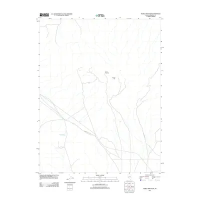
2011 Map of Mable Mountain
USGS Topo · Published 2011About this map
Mable Mountain stands as a primary landmark within this high-desert portion of Mineral County. The terrain is defined by the sharp relief of the Garfield Hills, where drainages and elevation contours reveal a landscape shaped by arid processes. Isolated water resources are scarce, represented here by the Garfield Reservoir Number Three, a feature that suggests managed water control for mining or ranching interests common to this region of Nevada. Modern infrastructure is limited to the crossing of Garfield Flats Rd and the utility corridor followed by Powerline Rd, which cut through the open basin floor. This 2011 survey documents a sparsely populated but strategically utilized territory where transportation and water management are the primary indicators of human presence in the desert interior.
Find a feature on this map
5 named features on this map. Tap any name to fly to it.
Don’t see what you’re looking for? This feature index may not catch every label — zoom into the map to look around manually.
Map Details
Editions of this 2011 Mable Mountain Map
This is the sole edition of this map. No revisions or reprints were ever made.
Other maps of this area

1909 · Hawthorne
USGS Topo · 1:250,000

1911 · Hawthorne
USGS Topo · 1:250,000

1915 · Hawthorne
USGS Topo · 1:250,000

1948 · Walker Lake
USGS Topo · 1:250,000

1957 · Walker Lake
USGS Topo · 1:250,000

1962 · Walker Lake
USGS Topo · 1:250,000

1964 · Walker Lake
USGS Topo · 1:250,000

1967 · Pamlico
USGS Topo · 1:24,000

1967 · Moho Mountain
USGS Topo · 1:24,000

1967 · Mina NW
USGS Topo · 1:24,000