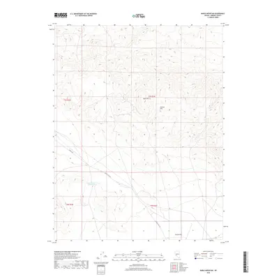
2018 Map of Mable Mountain
USGS Topo · Published 2018About this map
Mable Mtn rises as a central landmark within the high-desert landscape of Mineral County, anchoring a terrain defined by the complex ridges of the Garfield Hills. This 2018 survey documents a remote interior of Nevada where water management is critical to the arid environment, evidenced by the presence of Garfield Reservoir Number Three. The landscape transitions from these elevated peaks down into the broad, low-lying expanse of Garfield Flat in the southeast. Infrastructure is sparse, primarily consisting of corridors like Garfield Rd and Garfield Flats Rd that navigate the varied elevations. The map provides a clear record of the Public Land Survey System grid, including the convergence of township lines such as t7n r33e and t6n r32e, which are essential for property and resource tracking in the Great Basin.
Find a feature on this map
10 named features on this map. Tap any name to fly to it.
Don’t see what you’re looking for? This feature index may not catch every label — zoom into the map to look around manually.
Map Details
Editions of this 2018 Mable Mountain Map
This is the sole edition of this map. No revisions or reprints were ever made.
Other maps of this area

1909 · Hawthorne
USGS Topo · 1:250,000

1911 · Hawthorne
USGS Topo · 1:250,000

1915 · Hawthorne
USGS Topo · 1:250,000

1948 · Walker Lake
USGS Topo · 1:250,000

1957 · Walker Lake
USGS Topo · 1:250,000

1962 · Walker Lake
USGS Topo · 1:250,000

1964 · Walker Lake
USGS Topo · 1:250,000

1967 · Pamlico
USGS Topo · 1:24,000

1967 · Moho Mountain
USGS Topo · 1:24,000

1967 · Mina NW
USGS Topo · 1:24,000