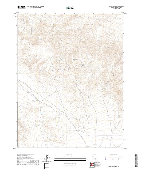
2021 Map of Mable Mountain
USGS Topo · Published 2021About this map
Mable Mtn stands as a prominent high point within the Garfield Hills, overlooking a landscape defined by the vast drainage of Garfield Flat in Mineral County, Nevada. This high-desert terrain is marked by the presence of Garfield Reservoir Number Three, a critical water management feature in an otherwise arid environment. The map details the network of desert tracks that traverse the area, including Garfield Rd and Garfield Flats Rd, which follow the natural contours of the alluvial fans. The grid of township and range boundaries, such as t7n r33e, provides a look at the systematic land division used to manage these open spaces in the Great Basin.
Find a feature on this map
10 named features on this map. Tap any name to fly to it.
Don’t see what you’re looking for? This feature index may not catch every label — zoom into the map to look around manually.
Map Details
Editions of this 2021 Mable Mountain Map
This is the sole edition of this map. No revisions or reprints were ever made.
Other maps of this area

1909 · Hawthorne
USGS Topo · 1:250,000

1911 · Hawthorne
USGS Topo · 1:250,000

1915 · Hawthorne
USGS Topo · 1:250,000

1948 · Walker Lake
USGS Topo · 1:250,000

1957 · Walker Lake
USGS Topo · 1:250,000

1962 · Walker Lake
USGS Topo · 1:250,000

1964 · Walker Lake
USGS Topo · 1:250,000

1967 · Pamlico
USGS Topo · 1:24,000

1967 · Moho Mountain
USGS Topo · 1:24,000

1967 · Mina NW
USGS Topo · 1:24,000