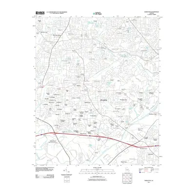
2011 Map of Mableton
USGS Topo · Published 2011About this map
The Chattahoochee River forms a natural border in this suburbanizing landscape west of Atlanta, where early industry and modern infrastructure meet. Historic remnants of the nineteenth-century milling economy are preserved at Ruffs Mill and the Concord Covered Bridge along Nickajack Creek. The map documents a dense network of residential developments and family-named cemeteries, such as the Little Bethel Cemetery and Cox-Morrow-Mitchell Cemetery, which serve as vital landmarks for local genealogists. In the southern portion of the quadrangle, the industrial and commercial character of the region is evident through the sprawling Fulton County Airport-Brown Field and the Lee Industrial Blvd corridor. Educational and professional hubs are represented by the Mercer University Douglas County Regional Academic Center and The Bluffs Office Park, reflecting the area's continued expansion at the start of the twenty-first century.
Find a feature on this map
154 named features on this map. Tap any name to fly to it.
Don’t see what you’re looking for? This feature index may not catch every label — zoom into the map to look around manually.
Map Details
Editions of this 2011 Mableton Map
This is the sole edition of this map. No revisions or reprints were ever made.
Other maps of this area

1888 · Atlanta
USGS Topo · 1:125,000

1890 · Atlanta
USGS Topo · 1:125,000

1891 · Marietta
USGS Topo · 1:125,000

1892 · Atlanta
USGS Topo · 1:125,000

1895 · Atlanta
USGS Topo · 1:125,000

1895 · Marietta
USGS Topo · 1:125,000

1897 · Marietta
USGS Topo · 1:125,000

1901 · Marietta
USGS Topo · 1:125,000

1953 · Atlanta
USGS Topo · 1:250,000

1954 · Campbellton
USGS Topo · 1:24,000