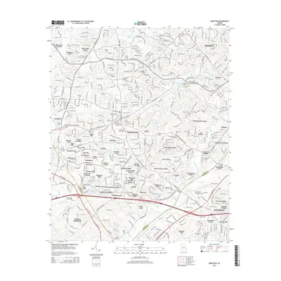
2014 Map of Mableton
USGS Topo · Published 2014About this map
The Chattahoochee River forms the prominent southeastern boundary of this suburban landscape, where the convergence of Cobb and Fulton counties meets the industrial expansion of the Atlanta metro area. Early 21st-century development is evident in the dense residential clusters of Mableton and Smyrna, while the Lee Industrial Blvd SW corridor signifies the region's commercial growth. For genealogists and local historians, the area is notably rich in family-named burial grounds and memorials, such as Cox-Morrow Mitchell Cem, Pace Wallace Cem, and the Mableton Memorial Gardens Cem. The Fulton County Airport-Brown Field stands as a central landmark near the river, anchoring a landscape defined by historic crossings and modern infrastructure like Veterans Memorial Hwy. Smaller communities like Brenda Heights, Leland, and Johnstons Crossing reflect the intricate neighborhood-level history of the region.
Find a feature on this map
118 named features on this map. Tap any name to fly to it.
Don’t see what you’re looking for? This feature index may not catch every label — zoom into the map to look around manually.
Map Details
Editions of this 2014 Mableton Map
This is the sole edition of this map. No revisions or reprints were ever made.
Other maps of this area

1888 · Atlanta
USGS Topo · 1:125,000

1890 · Atlanta
USGS Topo · 1:125,000

1891 · Marietta
USGS Topo · 1:125,000

1892 · Atlanta
USGS Topo · 1:125,000

1895 · Atlanta
USGS Topo · 1:125,000

1895 · Marietta
USGS Topo · 1:125,000

1897 · Marietta
USGS Topo · 1:125,000

1901 · Marietta
USGS Topo · 1:125,000

1953 · Atlanta
USGS Topo · 1:250,000

1954 · Campbellton
USGS Topo · 1:24,000