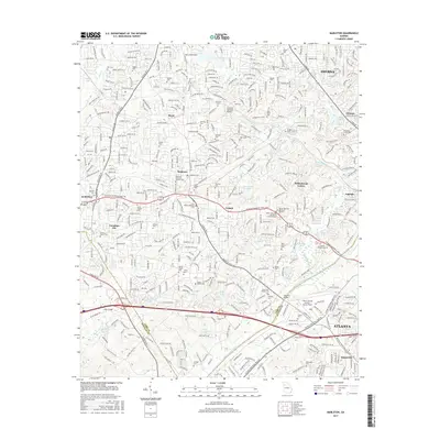
2017 Map of Mableton
USGS Topo · Published 2017About this map
The Chattahoochee River forms a natural boundary between Cobb and Fulton counties in this 2017 study of the western Atlanta suburbs. The landscape is a dense network of suburban expansion, where long-standing landmarks like the Concord Covered Bridge over Nickajack Creek persist alongside modern aviation infrastructure at Fulton County Airport-Brown Field. The map reveals the deep-rooted community history of Mableton, Austell, and Smyrna through an extensive collection of family and memorial burial grounds.
Find a feature on this map
78 named features on this map. Tap any name to fly to it.
Don’t see what you’re looking for? This feature index may not catch every label — zoom into the map to look around manually.
Map Details
Editions of this 2017 Mableton Map
This is the sole edition of this map. No revisions or reprints were ever made.
Other maps of this area

1888 · Atlanta
USGS Topo · 1:125,000

1890 · Atlanta
USGS Topo · 1:125,000

1891 · Marietta
USGS Topo · 1:125,000

1892 · Atlanta
USGS Topo · 1:125,000

1895 · Atlanta
USGS Topo · 1:125,000

1895 · Marietta
USGS Topo · 1:125,000

1897 · Marietta
USGS Topo · 1:125,000

1901 · Marietta
USGS Topo · 1:125,000

1953 · Atlanta
USGS Topo · 1:250,000

1954 · Campbellton
USGS Topo · 1:24,000