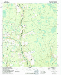
1994 Map of Macclenny NW
USGS Topo · Published 1994About this map
The St Marys River winds along the interstate boundary between Charlton County, Georgia, and Florida, defining the central geography of this 1994 survey. To the west, the Osceola National Forest encompasses a landscape of low-lying wetlands and timber stands, including Moccasin Bay and Bluff Creek Bay. The map documents a rural infrastructure of named roads such as Frederick Raulerson Road and Rex Fish Road, which serve scattered landmarks of high genealogical interest. Local congregational life is represented by Monlac Ch, North Prong Ch, and Cayler Ch, while the Canaday Cem near Joaquin Creek provides a specific point of reference for family historians. The drainage network is particularly detailed, showing the Middle Prong and numerous tributaries like Tiger Creek and Sparkman Creek feeding into the main river channel.
Find a feature on this map
29 named features on this map. Tap any name to fly to it.
Don’t see what you’re looking for? This feature index may not catch every label — zoom into the map to look around manually.
Map Details
Editions of this 1994 Macclenny NW Map
This is the sole edition of this map. No revisions or reprints were ever made.
Other maps of this area

1917 · Macclenny
USGS Topo · 1:62,500

1918 · Moniac
USGS Topo · 1:62,500

1918 · Macclenny
USGS Topo · 1:62,500

1942 · Moniac
USGS Topo · 1:62,500

1954 · Valdosta
USGS Topo · 1:250,000

1956 · Eddy
USGS Topo · 1:24,000

1958 · Valdosta
USGS Topo · 1:250,000

1959 · Valdosta
USGS Topo · 1:250,000
1966 · St George
USGS Topo · 1:24,000
1967 · Moniac
USGS Topo · 1:24,000