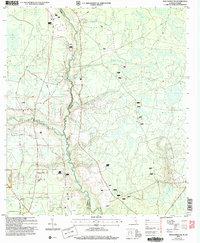
2006 Map of Macclenny NW
USGS Topo · Published 2007About this map
The St Marys River and its North Prong form a winding natural border between Baker County, Florida, and Charlton County, Georgia, defining this rural landscape. This 2006 revision, based on earlier topographic data, illustrates the dense network of unpaved roads and forest tracks that crisscross the Osceola National Forest. The map captures a largely unincorporated area where local geography is anchored by family-named landmarks and rural congregations, such as Moniac Ch near the state line and Cuyler Ch further south.
Find a feature on this map
27 named features on this map. Tap any name to fly to it.
Don’t see what you’re looking for? This feature index may not catch every label — zoom into the map to look around manually.
Map Details
Editions of this 2006 Macclenny NW Map
This is the sole edition of this map. No revisions or reprints were ever made.
Other maps of this area

1917 · Macclenny
USGS Topo · 1:62,500

1918 · Moniac
USGS Topo · 1:62,500

1918 · Macclenny
USGS Topo · 1:62,500

1942 · Moniac
USGS Topo · 1:62,500

1954 · Valdosta
USGS Topo · 1:250,000

1956 · Eddy
USGS Topo · 1:24,000

1958 · Valdosta
USGS Topo · 1:250,000

1959 · Valdosta
USGS Topo · 1:250,000
1966 · St George
USGS Topo · 1:24,000
1967 · Moniac
USGS Topo · 1:24,000