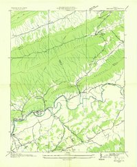
1935 Map of Maccrady
USGS Topo · Published 1935About this map
The industrial and rural landscape of Smyth and Tazewell Counties is documented here by the Tennessee Valley Authority and Arthur E. Morgan. The winding corridor of the North Fork Holston River serves as the primary artery for settlement and industry, most notably at the Mathieson Alkali Works R. R. near Saltville and Maccrady. This rail and river network supported a valley economy of chemical production and salt mining that defined the region’s development through the mid-1930s.
Find a feature on this map
45 named features on this map. Tap any name to fly to it.
Don’t see what you’re looking for? This feature index may not catch every label — zoom into the map to look around manually.
Map Details
Editions of this 1935 Maccrady Map
This is the sole edition of this map. No revisions or reprints were ever made.
Other maps of this area

1891 · Tazewell
USGS Topo · 1:125,000

1891 · Abingdon
USGS Topo · 1:125,000

1894 · Abingdon
USGS Topo · 1:125,000

1895 · Tazewell
USGS Topo · 1:125,000

1897 · Tazewell
USGS Topo · 1:125,000

1909 · Abingdon
USGS Topo · 1:96,000

1911 · Abingdon
USGS Topo · 1:125,000

1912 · Pounding Mill
USGS Topo · 1:62,500

1915 · Richlands
USGS Topo · 1:48,000

1916 · Pounding Mill
USGS Topo · 1:62,500