Loading...
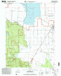
Loading map...2001 Map of Macdoel
USGS Topo · Published 2004About this map
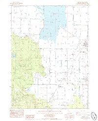
The high basin of Butte Valley transitions from the wetlands of Meiss Lake to the timbered slopes of the Klamath National Forest. At the turn of the 21st century, this landscape was defined by its agricultural legacy and conservation areas, including the Butte Valley National Grassland and the Butte Valley Wildlife Area. The town of Macdoel serves as the primary settlement, supported by the Macdoel District Sch and adjacent to the Butte County Railroad.
Find a feature on this map
26 named features on this map. Tap any name to fly to it.
Don’t see what you’re looking for? This feature index may not catch every label — zoom into the map to look around manually.
Map Details
Date Portrayed2001
Date Published2004
PublisherU.S. Geological Survey
Map TypeTopographic
Scale1:24,000
Physical Dimensions21.4 x 26.7 inches
Editions of this 2001 Macdoel Map
This is the sole edition of this map. No revisions or reprints were ever made.
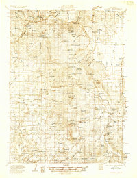
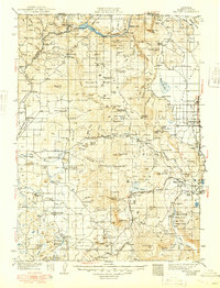
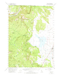
Historical Maps of Mount Hebron Through Time
5 maps found
Featured Locations
Source Details
SourceU.S. Geological Survey
CopyrightPublic Domain