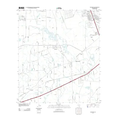
2013 Map of Macdona
USGS Topo · Published 2013About this map
The Medina River meanders through this southwest Bexar County landscape, defining the character of small settlements like Macdona and Von Ormy. As of 2013, the area shows a clear transition from agricultural and ranching operations, such as the Straus Medina Ranch and Luckey Ranch, toward residential developments like Valley Hi near the Lackland Air Force Base Annex Rd. The extractive industry is well-represented by the Gas Ridge Oil Field and Von Ormy Oil Field, which punctuate the river valley. Genealogists will find significant value in the high density of small family or community burial grounds, including Becker Cem, Arnold Cem, and Lessing Cem, many of which sit on former ranch lands. Water remains a central feature of the local geography, with Live Oak Slough and Medio Cr feeding into the main river channel.
Find a feature on this map
125 named features on this map. Tap any name to fly to it.
Don’t see what you’re looking for? This feature index may not catch every label — zoom into the map to look around manually.
Map Details
Editions of this 2013 Macdona Map
This is the sole edition of this map. No revisions or reprints were ever made.
Other maps of this area

1942 · Natalia
USGS Topo · 1:62,500

1953 · Culebra Hill
USGS Topo · 1:24,000

1953 · San Antonio West
USGS Topo · 1:24,000

1953 · Terrell Wells
USGS Topo · 1:24,000

1953 · Macdona
USGS Topo · 1:24,000

1954 · San Antonio
USGS Topo · 1:250,000

1957 · San Antonio
USGS Topo · 1:250,000

1958 · La Coste
USGS Topo · 1:24,000

1958 · Somerset
USGS Topo · 1:24,000

1958 · La Coste NE
USGS Topo · 1:24,000