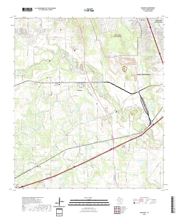
2022 Map of Macdona
USGS Topo · Published 2022About this map
The Medina River corridor southwest of San Antonio defines this landscape, where early Texas settlements and family-owned lands meet the expanding infrastructure of the modern era. The community of Macdona serves as a central point, surrounded by a high density of small family and community burial grounds including Becker Cem, Arnold Cem, and the Hermann Sons Cem. These sites, along with San Isidro Cem and Our Lady Queen of Heaven Cem, offer significant primary data for genealogical research in Bexar County.
Find a feature on this map
139 named features on this map. Tap any name to fly to it.
Don’t see what you’re looking for? This feature index may not catch every label — zoom into the map to look around manually.
Map Details
Editions of this 2022 Macdona Map
This is the sole edition of this map. No revisions or reprints were ever made.
Other maps of this area

1942 · Natalia
USGS Topo · 1:62,500

1953 · Culebra Hill
USGS Topo · 1:24,000

1953 · San Antonio West
USGS Topo · 1:24,000

1953 · Terrell Wells
USGS Topo · 1:24,000

1953 · Macdona
USGS Topo · 1:24,000

1954 · San Antonio
USGS Topo · 1:250,000

1957 · San Antonio
USGS Topo · 1:250,000

1958 · La Coste
USGS Topo · 1:24,000

1958 · Somerset
USGS Topo · 1:24,000

1958 · La Coste NE
USGS Topo · 1:24,000